Sarah Hinshaw

and 1 more

Floodplain restoration can enhance capacity for carbon sequestration by facilitating higher water tables, deposition of fine sediment, and increased input and residence time of organic matter. We measured floodplain soil organic carbon stocks in nine stream restoration projects across the western United States and compared them to nearby degraded and reference condition floodplains. Degraded floodplains had the lowest soil mean carbon stocks in the majority of floodplains measured (range 161-894 Mg C/ha), and reference stocks had the highest stocks (range 391-904 Mg C/ha) of those with statistically significant differences between the three categories. Across all sites measured, stream restoration sites, referred to as treatment sites, had stocks (range 203-1028 Mg C/ha) similar to degraded condition floodplains but the largest range. When modeled under degraded conditions, four out of nine of the treatment sites had significantly higher OC stocks than predicted. Climate and geologic variables are most influential in predicting carbon stocks, and floodplains in the interior western USA have the highest carbon stocks. As the demand for carbon sequestration increases due to climate change, ecologically responsible floodplain restoration provides a significant opportunity for carbon storage. However, despite the statistically significant relationships we observed in this dataset, the variations within the data in relation to degraded/treatment/reference categories illustrate the uncertainties in quantifying the effects of restoration on floodplain carbon stocks.

Nicholas A Sutfin

and 4 more

The flow of organic matter (OM) along rivers and its retention within floodplains are fundamental to the function of aquatic and riparian ecosystems and are significant components of terrestrial carbon storage and budgets. Carbon storage and ecosystem processing of OM largely depends upon hydrogeomorphic characteristics of streams and valleys. To examine the role of channel complexity on carbon dynamics in mountain streams, we (1) quantify organic carbon (OC) storage in sediment and wood along 24 forested stream reaches in the Rocky Mountains of CO, U.S.A., (2) employ six years of logjam surveys and examine related morphological factors that regulate sediment and carbon storage, and (3) utilize fluorescence spectroscopy to examine how the composition of OM in surface water and floodplain soil leachates is influenced by valley and channel morphology. We find that lower-gradient stream reaches in unconfined valley segments at high elevations store more OC per area than higher-gradient reaches in more confined valleys, and those at lower elevations. We find that limited storage of fine sediment and increased mineralization of OC in multithread channel reaches decrease storage per area compared to simpler single-thread channel reaches. Results suggest that the positive feedbacks between channel complexity and persistent channel-spanning logjams that force multiple channels to flow across valley bottoms limit the aggradation of floodplain fine sediment, and promote hotspots for the transformation of OM. These multithread hotspots likely increase ecosystem productivity and ecosystem services by filtering dissolved organic carbon with potential to decrease contaminants associated with organic matter from surface water.

Richard Knox

and 2 more

Recent advances in Earth observation data and computing ability create exciting opportunities for national and global studies of human impacts to water resources. But, with a lack of complete databases of artificial levees, there remains a need to better understand how artificial levees impact floodplain extent at regional and larger scales. Here, we estimate river-floodplain disconnection in the contiguous United States using an incomplete artificial levee database, machine learning algorithms, and hydrogeomorphic floodplain delineation models. We tested different topographic, land use, and spatial variables with different machine learning techniques in a case study of seven geographically diverse HUC8 basins before applying the technique at the national scale. We found that a parsimonious random forest model without topographic variables was 97% accurate. When applied to areas within a national 100-year hydrogeomorphic floodplain, the model indicated the potential for more than 180,000 km of undocumented artificial levees, meaning that the National Levee Database (NLD) is about 20% complete. More than 62% of potential levees are concentrated in the Upper and Lower Mississippi and Missouri basins. The stream order distribution of potential and NLD levees are similar; however, potential levees are primarily located along stream orders 3 and 6 while the NLD locations are along stream orders 2, 3 and 4. Using this, we explored the national impacts of artificial levees on floodplain extent by comparing two hydrogeomorphic floodplains based on (1) an unmodified USGS 1 arc second DEM and (2) a modified DEM with known and potential levees erased from the topography. We found that the overall impact of artificial levee removal was to shift the location of flooding. Over 30% of the CONUS 100-year floodplain was cultivated or developed land use.

Anna Marshall

and 4 more

Logjams in a stream create backwater conditions and locally force water to flow through the streambed, creating zones of transient storage within the surface and subsurface of a stream. We investigate the relative importance of logjam distribution density, logjam permeability, and discharge on transient storage in a simplified experimental channel. We use physical flume experiments in which we inject a salt tracer, monitor fluid conductivity breakthrough curves in surface water, and use breakthrough-curve skew to characterize transient storage. We then develop numerical models in HydroGeoSphere to reveal flow paths through the subsurface (or hyporheic zone) that contribute to some of the longest transient-storage timescales. In both the flume and numerical model, we observe an increase in backwater and hyporheic exchange at logjams. Observed complexities in transient storage behavior may depend largely on surface water flow in the backwater zone. As expected, multiple successive logjams provide more pervasive hyporheic exchange by distributing the head drop at each jam, leading to distributed but shallow flow paths. Decreasing the permeability of a logjam or increasing the discharge both facilitate more surface water storage and elevate the surface water level upstream of a logjam, thus increasing hyporheic exchange. Multiple logjams with low permeability result in the greatest magnitude of transient storage, suggesting that this configuration maximizes solute retention in backwater zones, while hyporheic exchange rates also increase. Understanding how logjam characteristics affect solute transport through both the channel and hyporheic zone has important management implications for rivers in forested, or historically forested, environments.

Daniel Scott

and 3 more

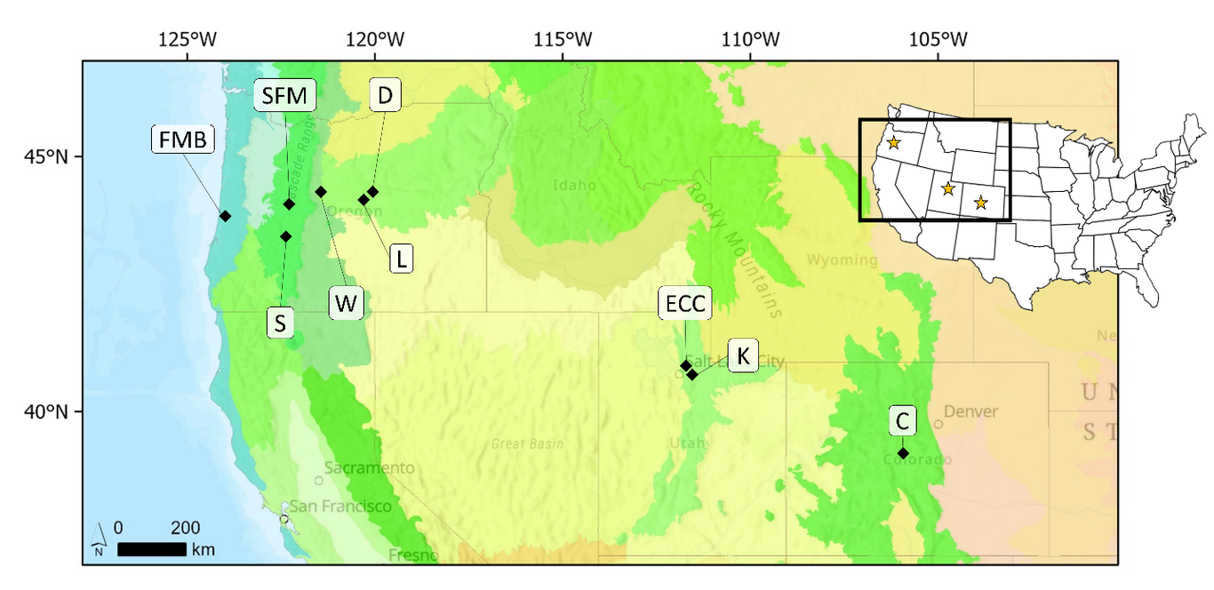
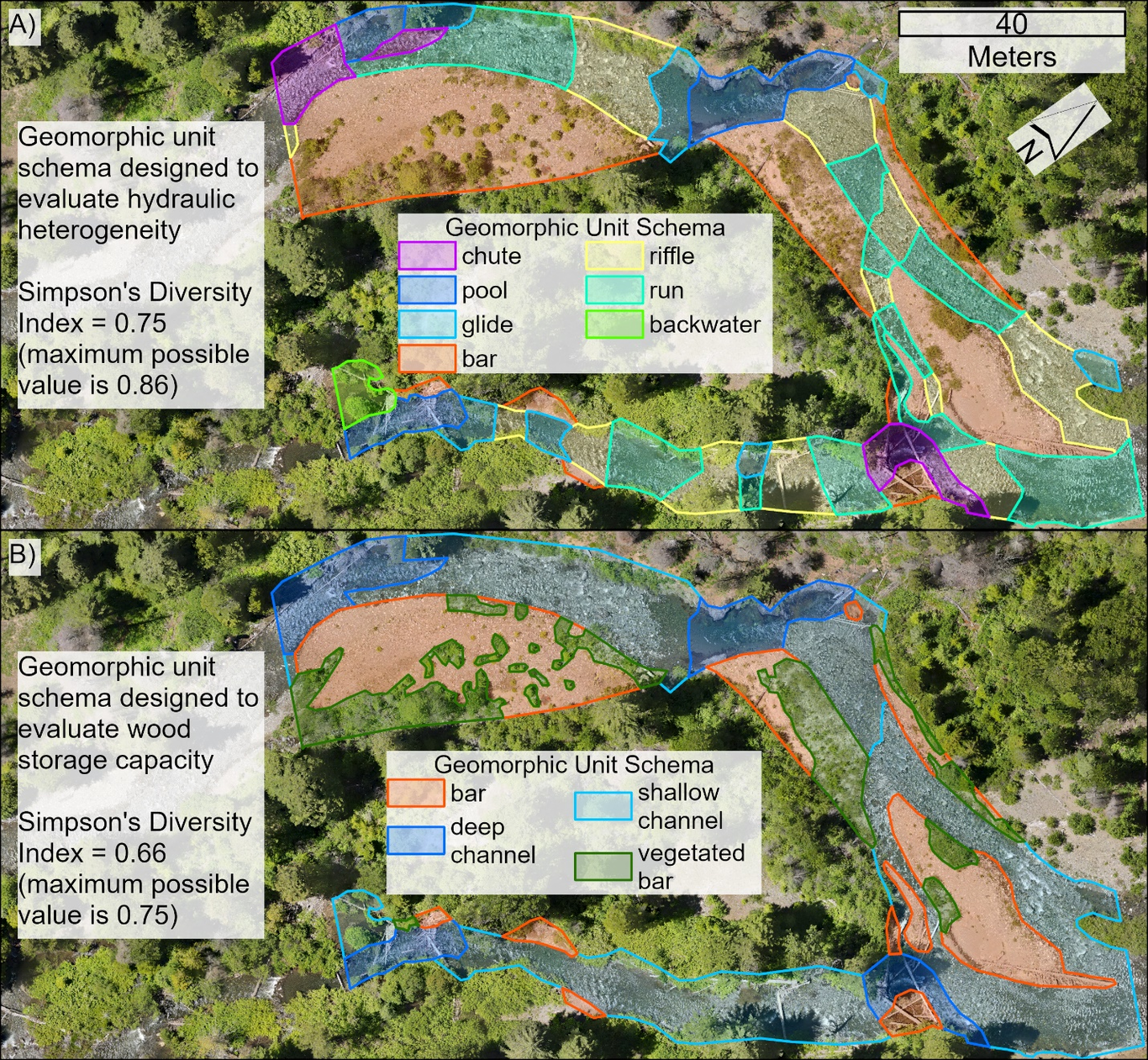
Spatial and temporal heterogeneity, or messiness, is a broadly desirable characteristic of river corridors and an indicator of many of the geomorphic processes that sustain fluvial ecosystems. However, quantifying geomorphic heterogeneity is complicated by a lack of consistent metrics, classification schemas for dividing the river corridor into the patches that form the basis for those metrics, and guidance on interpreting metrics. Drawing from both geomorphic and landscape ecology concepts, we offer ideas and guidance intended to help investigators, from researchers to restoration practitioners, more effectively and reliably use heterogeneity to describe river corridor processes and characteristics. We define geomorphic heterogeneity both spatially and temporally. Spatially, heterogeneity can be described by diversity, or the evenness and richness of geomorphic units, and spatial configuration, or the arrangement and shape of geomorphic units. Temporally, heterogeneity can be described by turnover rate, or the rate of change of geomorphic units. Interpretation of heterogeneity metrics depends integrally on the definition of the geomorphic unit schema on which metrics are based. Contextual information, such as measurements of process space (i.e., how much room a river has to move), disturbance frequency, and geomorphic trajectory, can also be key to interpreting measurements of heterogeneity. Geomorphic applications of heterogeneity require carefully defined geomorphic unit schemas that reflect processes and characteristics of interest, robust metrics of heterogeneity whose meaning is appropriate to the question at hand, and interpretation of those metrics based on the context of expected geomorphic processes and the disturbance regime.