J. Michael Johnson

and 7 more

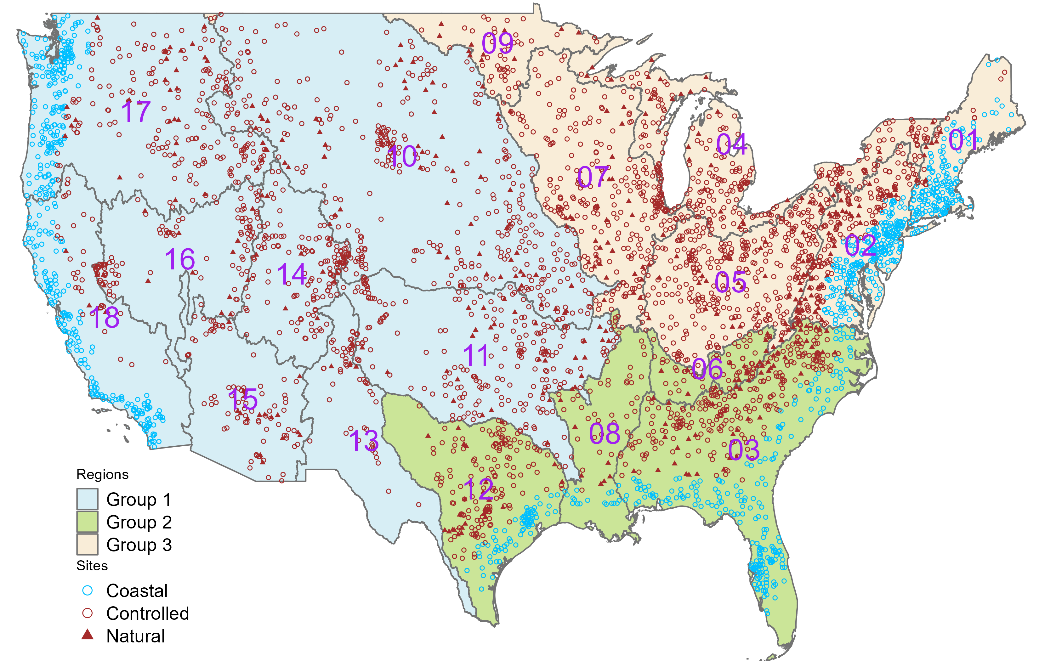
With an increasing number of continental-scale hydrologic models, the ability to evaluate performance is key to understanding uncertainty in prediction and making improvements to the model(s). In 2016, the NOAA National Water Model (NWM) was put into operations to improve the spatial and temporal resolution of hydrologic prediction in the U.S. Here, we evaluate the NWM 2.0 historical streamflow record in natural and controlled basins using the Nash Sutcliffe Efficiency metric decomposed into relative error, conditional, and unconditional bias. Each of these is evaluated in the contexts of categorized meteorologic, landscape, and anthropogenic characteristics to assess model performance and diagnose error types. Broadly speaking greater rainfall and snow coverage leads to improved performance while larger potential evapotranspiration (PET), aridity, and phase correlation reduce performance. More rainfall and phase correlation reduce overall bias, while increasing PET, aridity, snow coverage/fraction increase model bias. With respect to landscape traits, more barren and agricultural land yeild improved performance while more forest, shrubland, grassland and imperviousness tend to decrease performance. Lastly, more barren and herbaceous land tend to decrease bias, while greater imperviousness, urban, forest, and shrubland cover increase bias. The insights gained can help identify key hydrological factors in NWM predictions; enforce the need for regionalized physics and modeling; and help develop hybid post-processing methods to improve prediction. Finally, we demonstrate how the NOAA Next Generation Water Resource Modeling Framework can help reduce the structural bias through the application of heterogenous model processes and highlight opportunities for ongoing development and evaluation.

J. Michael Johnson

and 6 more

Rating curves are commonly developed through direct observation, open channel flow models, or mechanical methods, each relying on in-situ measurement. As part of a U.S. effort to provide high resolution, continental scale, flood mapping, synthetic rating curves (SRCs) were developed across the National Hydrography Dataset (NHDPlusV2) to translate flows, like those generated by the NOAA National Water Model, into river depths. This approach uses Digital Elevation Models (DEM) to define the necessary cross-sectional properties for Manning’s equation. A significant limitation, alongside an opportunity for broad improvement, has been assigning suitable roughness without local information. We applied the DEM based methodology to generate SRCs at 7,270 locations with known USGS rating curves, and calibrated roughness to minimize the error between predicted and observed flow. Subsequently, we tested several approaches based on land cover, stream order, and the hydrographic network to estimate the optimized values in a manner that can be extended to ungauged catchments. Among these, a predictive Machine Learning (ML) model based on the NHDPlusV2 network attributes demonstrated superior ability to estimate the optimized roughness with a Spearman correlation of 0.89. Sensitivity analysis showed improving accuracy of DEM and roughness is crucial for accurate estimation of the lower and mid/upper parts of SRC, respectively. Finally, we applied the predictive model over the NHDPlusV2, generating reach-level roughness estimates that can directly support national flood mapping efforts. The method is generalizable to any hydrofabric network that contains topology, however the generated values are dependent on the DEM and hydrofabric used.

Shiqi Fang

and 3 more