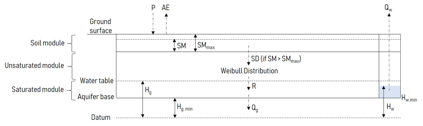
Drought Early Warning Systems (DEWSs) aim to spatially monitor and forecast risk of water shortage to inform early, risk-mitigating interventions. However, due to the scarcity of in-situ monitoring in groundwater-dependent arid zones, spatial drought exposure is inferred using maps of satellite-based indicators such as rainfall anomalies, soil moisture and vegetation indices. On the local scale, these coarse-resolution proxy indicators provide a poor inference of groundwater availability. The improving affordability and technical capability of modern sensors significantly increases the feasibility of taking direct groundwater level measurements in data-scarce, arid regions on a larger scale. Here, we assess the potential of in-situ monitoring to provide a localized index of hydrological drought in Somaliland. We find that calibrating a lumped groundwater model with a short time series of high-frequency groundwater level observations substantially improves the quantification of local water availability when compared to satellite-based indices over the same validation period. By varying the calibration length between 1-30 weeks, we find that data collection beyond 5 weeks adds little to model calibration at all three wells. This suggests that a short monitoring campaign is suitable to improve estimations of local water availability during drought, and provide superior performance compared to regional-scale satellite-based indicators. A short calibration period has practical advantages, as it allows for the relocation of sensors and rapid characterization of a large number of wells. A monitoring system with this contextualized, local information can support earlier financing and better targeting of early actions than regional DEWSs.