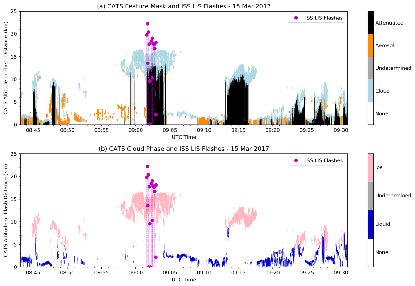
We will report on the first systematic comparison between global optical lightning measurements and backscatter lidar observations of cloud properties. The results suggest that lidar observations can provide significant insight into the global thunderstorm climatology and also enable new methods for quality control of spaceborne optical lightning observations. The International Space Station Lightning Imaging Sensor (ISS LIS) has been observing thunderstorms between +/-55° latitude since March 2017. During the first ~8 months of the mission the Cloud-Aerosol Transport System (CATS) lidar was co-located with LIS on the ISS. CATS provided vertical profiles of cloud and aerosol properties along a nadir curtain. For thunderstorms, CATS observations enabled retrieval of cloud-top height, the presence of liquid water vs. ice, and other important cloud properties that are relevant to the production of lightning. Through systematic comparison of ISS LIS and CATS granules, over 8000 LIS-detected flashes were matched with nearby coincident CATS profiles between 1 March and 30 October 2017. All of these flashes’ centroids were within 25 km of the CATS laser’s ground track. Two-dimensional histograms of cloud-top height and latitude show consistency with the expected global behavior of thunderstorm height – namely, that storm heights are constrained by the tropopause, which slopes downward toward the poles. The observed CATS/LIS trend was found to be consistent with long-term March-October thunderstorm 20-dBZ echo-top height climatologies derived from the Tropical Rainfall Measuring Mission (TRMM) and the Global Precipitation Measurement (GPM) mission (the latter combined with Worldwide Lightning Location Network data). However, the radar-based climatologies indicate that 20-dBZ echo tops average ~2 km lower in altitude compared to lidar-inferred cloud tops. The CATS lidar also enabled identification of potential LIS false alarms (FAs). Additional analyses, including lidar-inferred ice-cloud properties in thunderstorms (e.g., ice-water content), will be presented. Overall, this pathfinder study with a limited ~8-month dataset suggests that fruitful scientific insights may be expected from potentially larger combined lidar/lightning datasets.