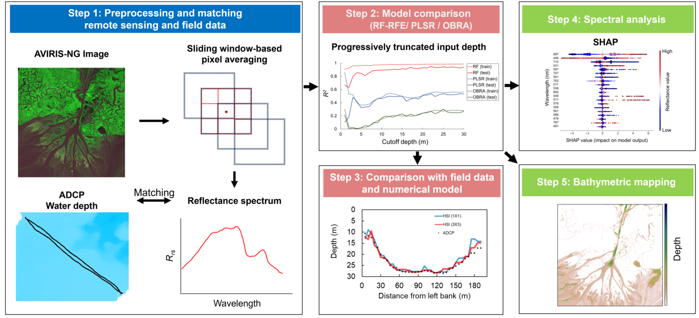
Remote sensing has been widely applied to investigate fluvial processes, but depth retrievals face significant constraints in deep and turbid conditions. This study evaluates the potential for depth retrievals under such challenging conditions using NASA’s Airborne Visible/Infrared Imaging Spectrometer-Next Generation (AVIRIS-NG) imagery. We employ interpretable machine learning to construct a hyperspectral regressor for water depth and explore the spectral characteristics of deep and turbid waters in Wax Lake Delta (WLD), LA. The reflectance spectra of WLD show minor effects from depth differences due to turbidity. Nevertheless, a Random Forest with Recursive Feature Elimination (RF-RFE) effectively generalizes high and low turbid cases in a single model, achieving a R² of 0.94 ± 0.005. Moreover, this model shows a maximum detectable depth of approximately 30 m, outperforming other methods. A spectral analysis using Shapley additive explanations (SHAP) points out the importance of learning various spectral bands and non-linear relationships between depth and reflectance. Specifically, the short blue and Near-InfraRed (NIR) bands, with high attenuation coefficients, play a crucial role. This finding highlights the attenuation as the key process for deep-depth retrievals. The depth maps of WLD captured by this model distinctly represent the spatial distribution of deep river and shallow delta regions. However, the high dependency on short blue and NIR bands leads to discontinuous areas due to the noise sensitivity of these bands. This result highlights a drawback of remote sensing using empirical models. Future research will focus on correcting such discontinuities by integrating data from multiple remote sensing sources.