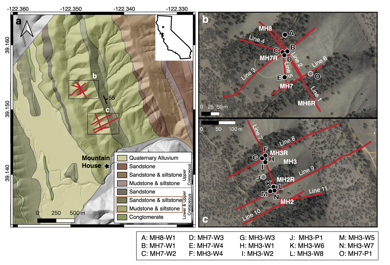
Understanding how soil thickness and bedrock weathering vary across ridge and valley topography is needed to constrain the flowpaths of water and sediment production within a landscape. Here, we investigate saprolite and weathered bedrock properties across a ridge-valley system in the Northern California Coast Ranges, USA, where topography varies with slope aspect such that north facing slopes have thicker soils and are more densely vegetated than south facing slopes. We use active source seismic refraction surveys to extend observations made in boreholes to the hillslope scale. Seismic velocity models across several ridges capture a high velocity gradient zone (from 1000 to 2500 m/s) located ~4-13 m below ridgetops, that coincides with transitions in material strength and chemical depletion observed in boreholes. Comparing this transition depth across multiple north and south-facing slopes, we find that the thickness of saprolite does not vary with slope aspects. Additionally, seismic survey lines perpendicular and parallel to bedding planes reveal weathering profiles that thicken upslope and taper downslope to channels. Using a rock physics model incorporating seismic velocity, we estimate the total porosity of the saprolite and find that inherited fractures contribute a substantial amount of pore space in the upper 6 m, and the lateral porosity structure varies strongly with hillslope position. The aspect-independent weathering structure suggests the contemporary critical zone structure at Rancho Venada is a legacy of past climate and vegetation conditions.