Bianca Adler

and 16 more

The structure and evolution of the atmospheric boundary layer (ABL) under clear-sky fair weather conditions over mountainous terrain is dominated by the diurnal cycle of the surface energy balance and thus strongly depends on surface snow cover. We use data from three passive ground-based infrared spectrometers deployed in the East River Valley in Colorado’s Rocky Mountains to investigate the response of the thermal ABL structure to changes in surface energy balance during the seasonal transition from snow-free to snow-covered ground. Temperature profiles were retrieved from the infrared radiances using the optimal estimation physical retrieval TROPoe. A nocturnal surface inversion formed in the valley during clear-sky days, which was subsequently mixed out during daytime with the development of a convective boundary layer during snow-free periods. When the ground was snow covered, a very shallow convective boundary layer formed, above which the inversion persisted through the daytime hours. We compare these observations to NOAA’s operational High-Resolution-Rapid-Refresh (HRRR) model and find large warm biases on clear-sky days resulting from the model’s inability to form strong nocturnal inversions and to maintain the stable stratification in the valley during daytime when there was snow on the ground. A possible explanation for these model shortcomings is the influence of the model’s relatively coarse horizontal grid spacing (3 km) and its impact on the model’s ability to represent well-developed thermally driven flows, specifically nighttime drainage flows.

Timothy W Juliano

and 6 more

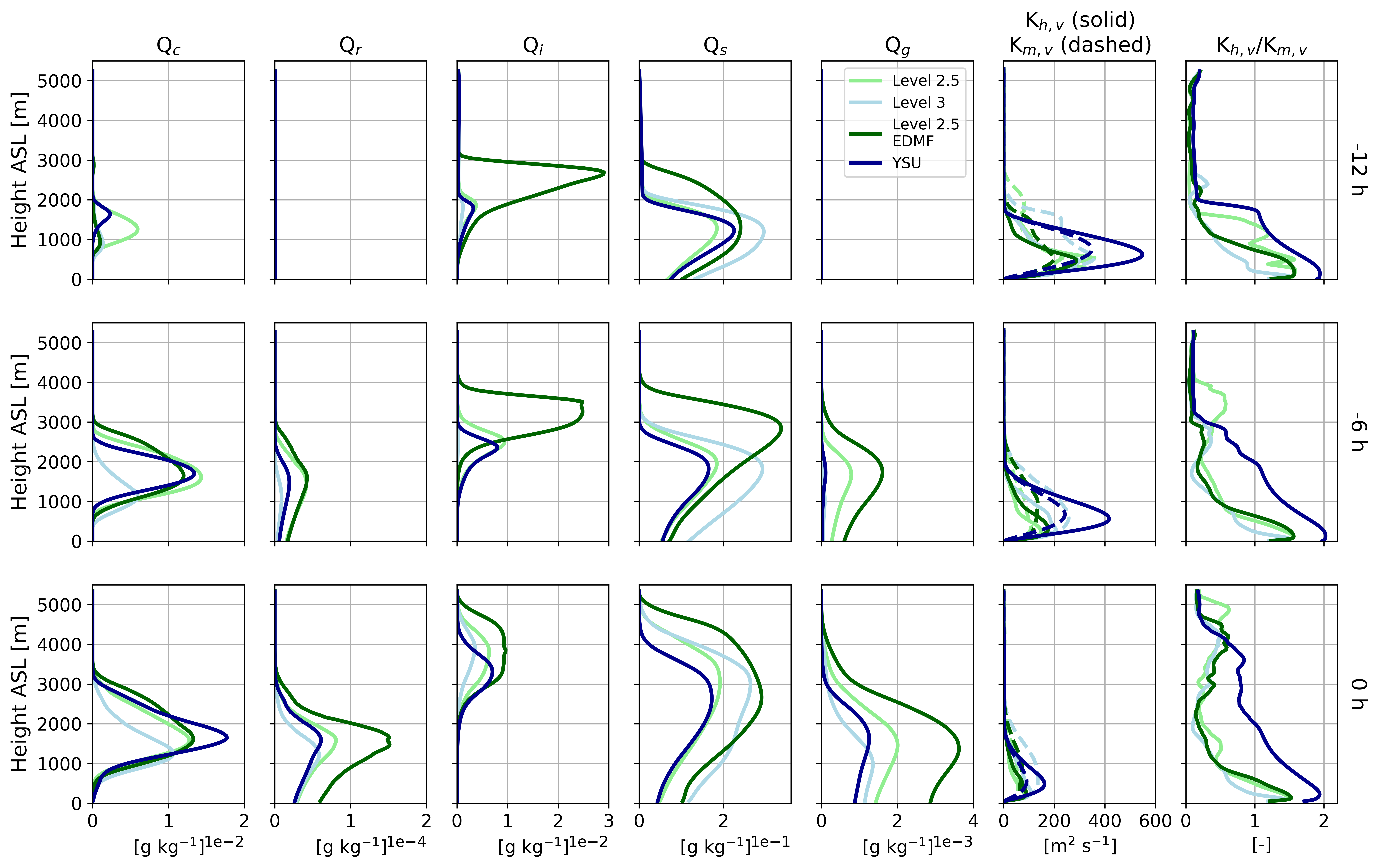
Marine cold-air outbreaks, or CAOs, are airmass transformations whereby relatively cold boundary layer (BL) air is transported over relatively warm water. Such convectively-driven conditions are rather ubiquitous in the high-latitudes, occurring most frequently during the winter and spring. To more deeply understand BL and cloud properties during CAO conditions, the Cold-Air Outbreaks in the Marine Boundary Layer Experiment (COMBLE) took place from late 2019 into early 2020. During COMBLE, the U.S. Department of Energy (DOE) first Atmospheric Radiation Measurement Mobile Facility (AMF1) was deployed to Andenes, Norway, far downstream (~1000 km) from the Arctic pack ice. This study examines the two most intense CAOs sampled at the AMF1 site. The observed BL structures are open cellular in nature with high (~3-5 km) and cold (-30 to -50 oC) cloud tops, and they often have pockets of high liquid water paths (LWPs; up to ~1000 g m-2) associated with strong updrafts and enhanced turbulence. We use a high-resolution mesoscale model to explore how well four different turbulence closure methods represent open cellular cloud properties. After applying a radar simulator to the model outputs for direct evaluation, we show that cloud top properties agree well with AMF1 observations (within ~10%), but radar reflectivity and LWP agreement is more variable. The eddy-diffusivity/mass-flux approach produces the deepest cloud layer and therefore the largest and most coherent cellular structures. Our results suggest that the turbulent Prandtl number may play an important role for the simulated BL and cloud properties.