Xiu HU

and 15 more

Faulting and folding of basement rocks together accommodate convergence within continental orogens, forming complex zones of intraplate deformation shaped by the fault interaction. Here we use the river terraces along the Dongda river to examine the tectonic deformation patterns of the hinterland and the foreland of the eastern North Qilian Shan, a zone of crustal shortening located at the northeast margin of the Tibetan Plateau. Five Late Pleistocene-Holocene terraces of Dongda river are displaced by three major reverse faults: Minle-Damaying fault, Huangcheng-Ta’erzhuang fault, and Fengle fault, from south to north. Based on displaced terrace treads, we estimated vertical slip rates along the Minle-Damaying fault as 0.7–1.2 mm/a, and along Fengle fault as 0.5–0.7 mm/a. Deformed terraces suggest additional uplift of ~ 0.2 mm/a through folding of the Dahuang Shan anticline. Inhomogeneous uplift of the intermontane basins between the Minle-Damaying fault and the Dahuang Shan anticline indicates a 0.9 ± 0.2 mm/a uplift rate along the Huangcheng-Ta’erzhuang fault. Kinematic modeling of this thrust system shows that deformation propagated northward toward the foreland along a south-dipping 10° décollement rooted into Haiyuan fault at the depth of 20–25 km. This system accommodates 2.7–3.8 mm/a total crustal shortening rate. We suggest this broad thrust belt and the relatively high rate of shortening within this part of the eastern Qilian Shan is as a result of the oblique convergence along a restraining bend of Haiyuan fault system. The elevated shortening rate within this area indicates high potential seismic hazard.

Yiran Wang

and 3 more

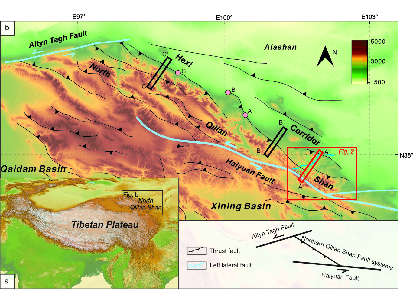
Located at the transition between monsoon and westerly dominated climate systems, major rivers draining the western Qilian Shan incise deep, narrow canyons into latest Quaternary foreland basin sediments of the Hexi Corridor. Field surveys show that the Beida River incised 135 m at mountain front over the Late Pleistocene and Holocene at an average rate of 0.006 m/yr. A steep knickzone, with 3% slope, initiated at the mountain front and has since retreated 10km upstream. Terrace dating results suggest that this knickzone formed around the mid-Holocene, over a duration of less than 1.5 kyr, during which incision accelerated to at least 0.035 m/yr. These incision rates are much larger than the uplift rate across the North Qilian fault, which suggests a climate-related increase in discharge drove rapid incision over the Holocene and formation of the knickzone. Using the relationship between incision rates and the amount of base level drop, we build a bedrock and foreland incision model for the Beida River system. We find that narrowing of channel width plays a key role, as important as increased channel slope, in enhancing the rate of river incision. Our model places the maximum duration of knickzone formation to about 600yr, and the minimum river discharge needed to trigger knickzone formation to be 1.7 times of the present discharge. This period of increased river discharge corresponds to a pluvial lake-filling event at the terminus of the Beida River and correlates with a wet period driven by strengthening of the Southeast Asian Monsoon.