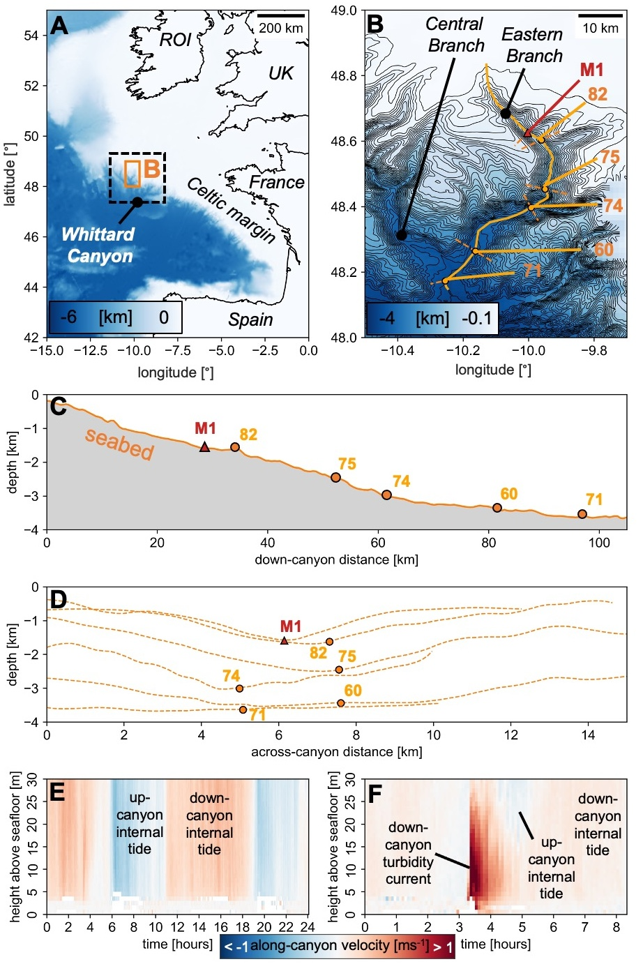
Turbidity currents transport vast quantities of sediment across the seafloor and form the largest sediment accumulations on Earth. These flows pose a hazard to strategically important seafloor infrastructure and are important agents for the transport of organic carbon and nutrients that support deep-sea ecosystems. Therefore, it is important to quantify the scale of these flows, the amount of sediment they transport, and the evolution of their discharge over time and space along their flow path. Two modes of flow evolution have been proposed based on experimental and numerical models. The first is termed ignition, where flows entrain seafloor sediment, becoming more voluminous and powerful and increasing their discharge. In the second mode of evolution, called dissipation, sediment falls out of suspension, so flows decelerate and lose discharge. Thus far, field-scale turbidity currents have only been measured at a handful of sites worldwide, and never in detail at multiple locations along their full course. Therefore, it has not yet been possible to determine when, where, and why flows diverge into these two modes in the deep sea, or how flow discharge varies. The ambitious multi-institution Coordinated Canyon Experiment measured turbidity currents at seven instrumented moorings along the Monterey Canyon, offshore California. Fifteen flows were recorded, including the fastest events yet measured at high resolution (>8 m/s). This remarkable dataset provides the first opportunity to quantify down-channel sediment and flow discharge evolution of turbidity currents in the deep sea. To understand whether flows ignite or dissipate, we derive total and sediment discharges for each of the flows at all seven mooring locations down the canyon. Discharges are calculated from measured velocities, and sediment concentrations are derived using a novel inversion method. We observe two distinct flow modes, as most flows rapidly dissipated in the upper reaches of the canyon, while three ran out for the full 50 km array length. We then explore why only these three flows ignited and discuss the implications for canyon and channel capacity and evolution.