Joel Carey Rowland

and 13 more

Whether the presence of permafrost systematically alters the rate of riverbank erosion is a fundamental geomorphic question with significant importance to infrastructure, water quality, and biogeochemistry of high latitude watersheds. For over four decades this question has remained unanswered due to a lack of data. Using remotely sensed imagery, we addressed this knowledge gap by quantifying riverbank erosion rates across the Arctic and subarctic. To compare these rates to non-permafrost rivers we assembled a global dataset of published riverbank erosion rates. We found that erosion rates in rivers influenced by permafrost are on average six times lower than non-permafrost systems; erosion rate differences increase up to 40 times for the largest rivers. To test alternative hypotheses for the observed erosion rate difference, we examined differences in total water yield and erosional efficiency between these rivers and non-permafrost rivers. Neither of these factors nor differences in river sediment loads provided compelling alternative explanations, leading us to conclude that permafrost limits riverbank erosion rates. This conclusion was supported by field investigations of rates and patterns of erosion along three rivers flowing through discontinuous permafrost in Alaska. Our results show that permafrost limits maximum bank erosion rates on rivers with stream powers greater than 900 W/m-1. On smaller rivers, however, hydrology rather thaw rate may be dominant control on bank erosion. Our findings suggest that Arctic warming and hydrological changes should increase bank erosion rates on large rivers but may reduce rates on rivers with drainage areas less than a few thousand km2.

Jon Schwenk

and 5 more

The tandem rise in satellite-based observations and computing power has changed the way we (can) see rivers across the Earth’s surface. Global datasets of river and river network characteristics at unprecedented resolutions are becoming common enough that the sheer amount of available information presents problems itself. Fully exploiting this new knowledge requires linking these geospatial datasets to each other within the context of a river network. In order to cope with this wealth of information, we are developing Veins of the Earth (VotE), a flexible system designed to synthesize knowledge about rivers and their networks into an adaptable and readily-usable form. VotE is not itself a dataset, but rather a database of relationships linking existing datasets that allows for rapid comparison and exports of river networks at arbitrary resolutions. VotE’s underlying river network (and drainage basins) is extracted from MERIT-Hydro. We link within VotE a newly-compiled dam dataset, streamflow gages from the GRDC, and published global river network datasets characterizing river widths, slopes, and intermittency. We highlight VotE’s utility with a demonstration of how vector-based river networks can be exported at any requested resolution, a global comparison of river widths from three independent datasets, and an example of computing watershed characteristics by coupling VotE to Google Earth Engine. Future efforts will focus on including real-time datasets such as SWOT river discharges and ReaLSAT reservoir areas.

Alejandro Tejedor

and 4 more

We present a new metric for braiding intensity to characterize multi-thread systems (e.g., braided and anastomosing rivers) called the Entropic Braiding Index, eBI. This metric is a generalization of the widely used Braiding Index (BI) which is simply the average count of intercepted channels per cross-section. The co-existence of diverse channels (widely different widths and discharges) within river cross-sections distorts the information conveyed by BI, since its value does not reflect the diversity and natural variability of the system. Moreover, the fact that BI is extremely sensitive to resolution (BI increases at higher resolution as smaller scale channels can be resolved) challenges its applicability. eBI, addresses these main drawbacks of BI. eBI is rooted in the concept of Shannon Entropy, and its value can be intuitively interpreted as the equivalent number of equally important (in terms of discharge) channels per cross-section. Thus, if the channels observed in a multi-thread system are all carrying the same amount of discharge, eBI has the same value of BI. On the other hand, if a very dominant channel in terms of discharge co-exists with much smaller channels, eBI would take a value slightly larger than 1 (note that the actual value would depend on the number of small channels and their relative size with respect to the dominant channel). We present a comparative study of BI and eBI for different multi-thread rivers obtained from numerical simulations and remote-sensing data and for different discharge stages. We also provide evidence of the robustness of eBI in contrast to BI when a given river system is studied under different resolutions. Finally, we explore the potential of eBI as a metric to characterize different types of multi-thread systems and their stability.

Tal Zussman

and 2 more

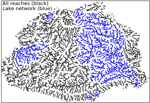
Watersheds serve as natural spatial boundaries whose characteristics are often indicators of the hydrologic processes within them. Watershed characteristics are frequently used as predictors, parameters, or proxies in models of hydrologic and ecologic dynamics. Developments in DEMs over the past decade have resulted in elevation data spanning the globe that allows watershed delineation at arbitrary locations. In tandem, satellite-based observations and large-scale modeling efforts provide many sources of near-global watershed characteristics, e.g. topography, soil types, vegetation, climate, permafrost extent, and many more. However, with growing data availability comes a growing need for tools that can rapidly query and summarize them. We developed River and Basin Profiler (RaBPro), a Python module providing a pipeline to delineate drainage basins for any point on Earth and calculate watershed statistics for practically any geospatial raster dataset. RaBPro makes use of the MERIT-Hydro or HydroBASINS datasets to define watershed polygons, which can be exported in GeoJSON or ESRI shapefile format for further use in GIS software. RaBPro will also generate streamlines and river elevation profiles. Finally, RaBPro calculates statistics over delineated basins using Google Earth Engine (GEE). By taking advantage of GEE’s vast dataset archive and distributed computing system, RaBPro can quickly compute many statistics over even very large basins efficiently and without the need for storing large geo-rasters locally. Additionally, users may upload their own datasets to GEE and create custom statistic functions.

Jemma Stachelek

and 2 more

Matthew G Cooper

and 7 more

Permafrost underlies approximately one fifth of the global land area and affects ground stability, freshwater runoff, soil chemistry, and surface‑atmosphere gas exchange. The depth of thawed ground overlying permafrost (active layer thickness, ALT) has broadly increased across the Arctic in recent decades, coincident with a period of increased streamflow, especially the lowest flows (baseflow). Mechanistic links between ALT and baseflow have recently been explored using linear reservoir theory, but most watersheds behave as nonlinear reservoirs. We derive theoretical nonlinear relationships between long‑term average saturated soil thickness η (proxy for ALT) and long-term average baseflow. The theory is applied to 38 years of daily streamflow data for the Kuparuk River basin on the North Slope of Alaska. Between 1983–2020, the theory predicts that η increased 0.11±0.17 [2σ] cm a-1, or 4.4±6.6 cm total. The rate of change nearly doubled to 0.20±0.24 cm a-1 between 1990–2020, during which time field measurements from CALM (Circumpolar Active Layer Monitoring) sites in the Kuparuk indicate η increased 0.31±0.22 cm a-1. The predicted rate of change more than doubled again between 2002–2020, mirroring a near doubling of observed ALT rate of change. The inferred increase in η is corroborated by GRACE (Gravity Recovery and Climate Experiment) satellite gravimetry, which indicates that terrestrial water storage increased ~0.80±3.40 cm a-1, ~56% higher than the predicted increase in η. Overall, hydrologic change is accelerating in the Kuparuk River basin, and we provide a theoretical framework for estimating changes in active layer water storage from streamflow measurements alone.