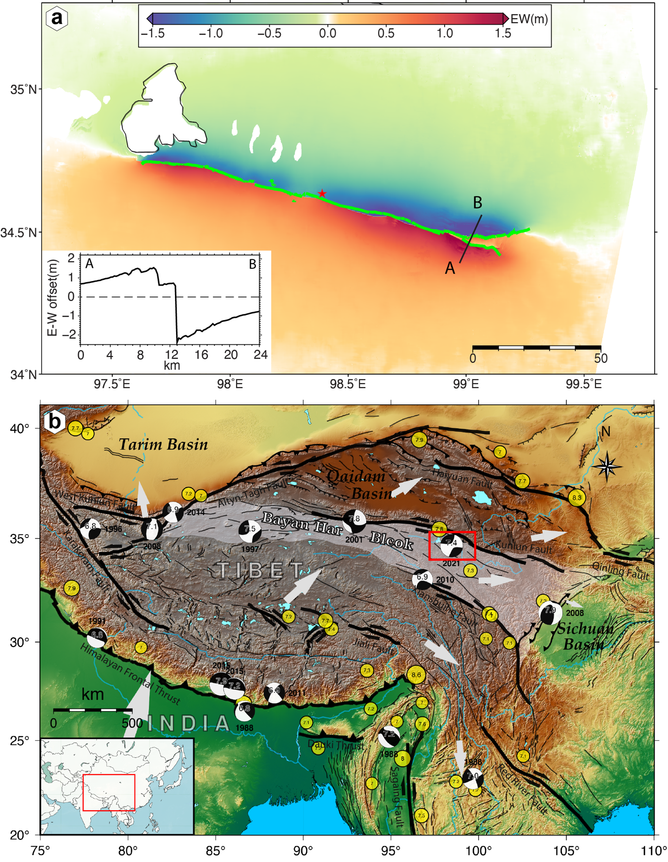
On 22ed May 2021 (local time), an earthquake of Ms7.4 struck Maduo county in Qinghai Province, China. This was the largest earthquake in China since the 2008 Wenchuan earthquake. In this study, ascending/descending Sentinel-1 and advanced land observation satellite-2 (ALOS-2) synthetic aperture radar (SAR) images were used to derive the three-dimensional (3-D) coseismic displacements of this earthquake. We used the differential interferometric SAR (InSAR, DInSAR), pixel offset-tracking (POT), multiple aperture InSAR (MAI), and burst overlap interferometry (BOI) methods to derive the displacement observations along the line-of-sight (LOS) and azimuth directions. To accurately mitigate the effect of ionospheric delay on the ALOS-2 DInSAR observations, a polynomial fitting method was proposed to optimize range-spectrum-split-derived ionospheric phases. In addition, the 3-D displacement field was obtained by a strain model and variance component estimation (SM-VCE) method based on the high-quality SAR displacement observations. Results indicated that a left-lateral fault slip with the largest horizontal displacement of up to 2.4 m dominated this earthquake, and the small-magnitude vertical displacement with an alternating uplift/subsidence pattern along the fault trace was more concentrated in the near-fault regions. Comparison with the global navigation satellite system data indicated that the SM-VCE method can significantly improve the accuracy of the displacements compared to the classical weighted least squares method, and the incorporation of the BOI displacements can substantially benefit the accuracy of north–south displacement. In addition to the displacements, three coseismic strain invariants calculated based on the strain model parameters were also investigated. It was found that the eastern and western parts of the faults suffered more significant strains compared with the epicenter region.