Peter Regier

and 7 more

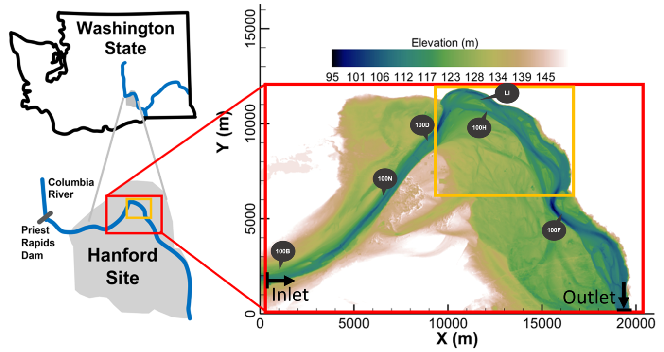
Authors: Peter Regier1, Kyongho Son2, Xingyuan Chen2, Yilin Fang2, Peishi Jiang2, Micah Taylor2, Wilfred M Wollheim3, James Stegen2Affiliations 1Marine and Coastal Research Laboratory, Pacific Northwest National Laboratory, Sequim, WA, United States2Pacific Northwest National Laboratory, Richland, WA, United States3University of New Hampshire, Durham, NH, United StatesAbstract:Hyporheic zones regulate biogeochemical processes in streams and rivers, but high spatiotemporal heterogeneity makes it difficult to predict how these processes scale from individual reaches to river basins. Recent work applying allometric scaling (i.e., power-law relationships between size and function) to river networks provides a new paradigm for understanding cumulative hyporheic biogeochemical processes. We used previously published model predictions of reach-scale hyporheic aerobic respiration to explore patterns in allometric scaling across two climatically divergent basins with differing characteristics in the Pacific Northwest, United States. In the model, hydrologic exchange fluxes (HEFs) regulate hyporheic respiration so we examined how HEFs might influence allometric scaling of respiration. We found consistent scaling behaviors where HEFs were either very low or very high, but differences between basins when HEFs were moderate. Our findings provide initial model-generated hypotheses for factors influencing allometric scaling of hyporheic respiration. These hypotheses can be used to optimize new data generation efforts aimed at developing predictive understanding of allometries that can, in turn, be used to scale biogeochemical dynamics across watersheds. 

Kyongho Son

and 4 more

Denitrification in the hyporheic zone (HZ) of river corridors is crucial to removing excess nitrogen in rivers from anthropogenic activities. However, previous modeling studies of the effectiveness of river corridors in removing excess nitrogen via denitrification were often limited to the reach-scale and low-order stream watersheds. We developed a basin-scale river corridor model for the Columbia River Basin with random forest models to identify the dominant factors associated with the spatial variation of HZ denitrification. Our modeling results suggest that the combined effects of hydrologic variability in reaches and substrate availability influenced by land use are associated with the spatial variability of modeled HZ denitrification at the basin scale. Hyporheic exchange flux can explain most of spatial variation of denitrification amounts in reaches of different sizes, while among the reaches affected by different land uses, the combination of hyporheic exchange flux and stream dissolved organic carbon (DOC) concentration can explain the denitrification differences. Also, we can generalize that the most influential watershed and channel variables controlling denitrification variation are channel morphology parameters (median grain size (D50), stream slope), climate (annual precipitation and evapotranspiration), and stream DOC-related parameters (percent of shrub area). The modeling framework in our study can serve as a valuable tool to identify the limiting factors in removing excess nitrogen pollution in large river basins where direct measurement is often infeasible.

Jean-Christophe Golaz

and 70 more

This work documents version two of the Department of Energy’s Energy Exascale Earth System Model (E3SM). E3SM version 2 (E3SMv2) is a significant evolution from its predecessor E3SMv1, resulting in a model that is nearly twice as fast and with a simulated climate that is improved in many metrics. We describe the physical climate model in its lower horizontal resolution configuration consisting of 110 km atmosphere, 165 km land, 0.5° river routing model, and an ocean and sea ice with mesh spacing varying between 60 km in the mid-latitudes and 30 km at the equator and poles. The model performance is evaluated by means of a standard set of Coupled Model Intercomparison Project Phase 6 (CMIP6) Diagnosis, Evaluation, and Characterization of Klima (DECK) simulations augmented with historical simulations as well as simulations to evaluate impacts of different forcing agents. The simulated climate is generally realistic, with notable improvements in clouds and precipitation compared to E3SMv1. E3SMv1 suffered from an excessively high equilibrium climate sensitivity (ECS) of 5.3 K. In E3SMv2, ECS is reduced to 4.0 K which is now within the plausible range based on a recent World Climate Research Programme (WCRP) assessment. However, E3SMv2 significantly underestimates the global mean surface temperature in the second half of the historical record. An analysis of single-forcing simulations indicates that correcting the historical temperature bias would require a substantial reduction in the magnitude of the aerosol-related forcing.

Yunxiang Chen

and 10 more

Quantifying the multiscale feedback between hydrodynamics and biogeochemistry is key to reliable modeling of river corridor systems. However, accurate and efficient hydrodynamics models over large spatiotemporal scales have not yet been established due to limited surveys of riverbed roughness and high computational costs. This work presents a semi-automated workflow that combines topographic and water stage surveys, computational fluid dynamics modeling, distributed wall resistance modeling, and high-performance computing to simulate flow in a 30-kilometer-long reach at the Columbia River during 2011-2019. The results show that this workflow enables a high accuracy in modeling water stage at all seven survey locations during calibration (1 month) and validation (65 months) periods. It also enables a high computational efficiency to model the streamflow during a 58-month solution-time within less than a 6-day wall-clock-time with mesh number, time step, and CPU hours of about 1.2 million, 3 seconds, and 1.1 million hours, respectively. Using the well-validated results, we show that riverbed dynamic pressure is randomly distributed over all spatiotemporal scales with its cross-sectional average values approximately quantified by a normal distribution with a mean and standard deviation of -0.353 m and 0.0352 m; bed shear stress is affected by flowrate and large- and small-scale topographic features with cross-sectional maximum values following a smooth but asymmetric distribution with 90% of its value falling between 5 Pa and 35 Pa; and hydrostatic pressure is influenced by flowrate and large-scale topographic features with cross-sectional maximum values quantified by a discontinuous and skewed distribution determined by streamwise topographic variations.