Molly E Tedesche

and 3 more

Perennial snowfields, such as those found in the Brooks Range in Alaska, are critical to alpine and arctic ecosystems, as they influence downslope hydrology, vegetation, geology, and serve as habitat for an array of wildlife, including caribou. Caribou are a crucial food and cultural resource for Alaska Native subsistence hunters. To understand extent changes and persistence of perennial snowfields, we developed a spatially distributed perennial snowfield melt model using the temperature melt index method, paired with multivariate binary logistic regression. Input data for calibration and evaluation of the model are a synthesis of climate reanalysis data and satellite imagery from both multi-spectral (optical) data and synthetic aperture radar (SAR). Temporal and spatial scale variations among input datasets, as well as variations in distribution and extents of the snowfields themselves, were accounted for using several methods. Snowfield metrics derived from remote sensing data were evaluated by comparison with field collected data. Probabilities of perennial snowfield melt at several thresholds were modeled using terrain-adjusted gridded temperature and net solar radiation data with a digital elevation model (DEM). Conditions of snowfield disappearance or persistence, from one melt season to the next, were derived from Sentinel-2 optical imagery. Pixel wise melt-onset and freeze-up dates were determined using a Sentinel-1 SAR backscatter intensity differencing approach. The model was calibrated in a focused study domain within the Brooks Range and evaluated in an alternate location around the Alaska Native village of Anaktuvuk Pass. Results of the perennial snowfield melt model indicate best performance at probability thresholds from 50% to 70%.  Local community members from the village of Anaktuvuk Pass were involved in field work decision making processes, as well as with data collection. The application of this model will be for quantifying one of many potential contributing factors to changes in arctic caribou herds that have been observed for some time by Alaska Native subsistence hunters. 

Molly E Tedesche

and 2 more

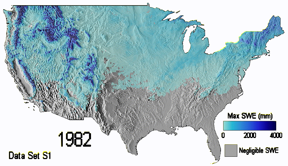
Much of the world’s water resource infrastructure was designed for specific regional snowmelt regimes under the assumption of a stable climate. However, as climate continues to change, this infrastructure is experiencing rapid regime shifts that test design limits. These changing snowmelt cycles are responsible for extreme hydrologic events occurring across the Contiguous United States (CONUS), such as river flooding from rain-on-snow, which puts infrastructure and communities at risk. Our study uses a new spatial snow regime classification system to track climate driven changes in snow hydrology across CONUS over 40 years (1981 – 2020). Using cloud-based computing and reanalysis data, regime classes are calculated annually, with changes evaluated across decadal and 30-year normal time scales. The snow regime classification designates areas across CONUS as: (1) rain dominated (RD), (2) snow dominated (SD), (3) transitional (R/S), or (4) perennial snow (PS). Classifications are thresholded using a ratio of maximum snow water equivalent (SWE) over accumulated cool-season precipitation, with a comparison of two approaches for selecting maximum SWE. Results indicate that average snow cover duration generally became shorter in each decade over our evaluation period, with rates of decline increasing at higher elevations. Anomalies in SD spatial extents, compared to the 30-year normal, decreased over the first three decades, while anomalies in RD extents increased. Also, previously SD areas have shifted to R/S, with boundary lines moving up in latitude. As water managers adapt to a changing climate, geospatial classification, such as this snow regime approach, may be a critical tool.